Remote sensing applications in Africa for mining and geological mapping
Monday, September 23, 2019
The development of a number of countries in Africa through the knowledge and institutional appreciation of its geological resources, beyond the specific studies for the exploitation of minerals and hydrocarbons, which have been so far.
Geological mapping information is the basis for the exploration and exploitation of natural resources of a country, but is also essential for a proper use of its territory.
The development of a geological map, using traditional techniques, is a slow and expensive process, with a large fieldwork and whose results are subject to ongoing review.
The existing geological mapping in these countries or is fragmented or small-scale (1:1000.000). The integration of the existing mapping with free data obtained from satellite, such as Digital Terrain Models (SRTM and ASTER GDEM) and Landsat 8 images allows the development of Previous Geological Mapping (PGM) to scale 1:100,000, using methodologies based on multicriteria analysis.
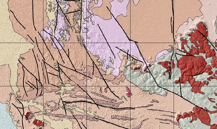
This paper compiles the methodological development carried out for the development of PGM of 16 sheets 1:100,000 in the SW Angola (provinces of Namibe, Huila and Cunene) from satellite data.
Read more: