Sentinel 2 monitoring Water Hyacint in Guadiana River
Monday, August 15, 2016
The Sentinel-2 mission consists of two satellites developed to support vegetation, land cover, and environmental monitoring. The Sentinel-2A satellite was launched by ESA on June 23, 2015, and operates in a sun-synchronous orbit with a 10-day repeat cycle. A second identical satellite (Sentinel-2B) is planned for the second half of 2016.
Sentinel 2A, with 10 meters of spatial resolution in Visible and Near-Infrared (VNIR) wavelengths, provides a continuous monitoring of over 150 km of Guadiana river affected by the development of an invasive species such as the water Hyacinth (Eichhornia Crassipes).
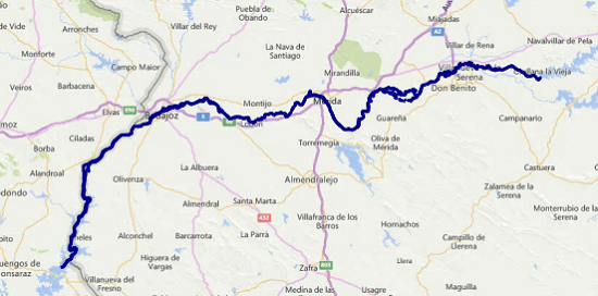 Location of Guadiana riverbed affected by water Hyacinth
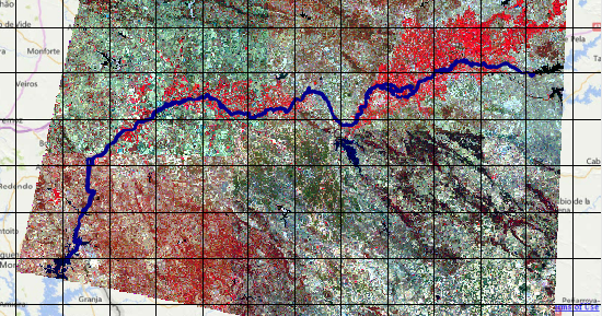 Infrared Sentinel 2A satellite image of the affected area by water Hyacinth
This spatial resolution is equivalent to more than 115,000 observation points scattered across the riverbed, which every 10 days sent us information about the vegetative development, biomass and photosynthetic activity of the water Hyacinth.
The contrast with ground truth, taken by AUV carrying a RGB camera with 3 cm of spatial resolution, shows the level of accuracy of Sentinel data.
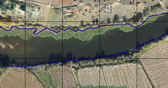 Image taken from UAV (usodrones) where water Hyacinth development can be seen
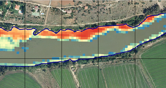 Skeletonization of a Sentinel 2A image, following the riverbed, synchronous with data taken by AUV. The gradation of colors indicates the varying degrees of vegetative and spatial development of water Hyacinth. The background image is a natural color orthophotography.
In addition, Sentinel images supplied by the European Space Agency are free, which reduces costs for early detection, mapping and evaluation of the water hyacinth masses.
Read more: